
 Local News
Underage girl dragged into toilet and sexually assaulted in Kyauktan
In Shwe Kone ward, Kyauktan town, Thanlyin district, Yangon region, a minor girl was…
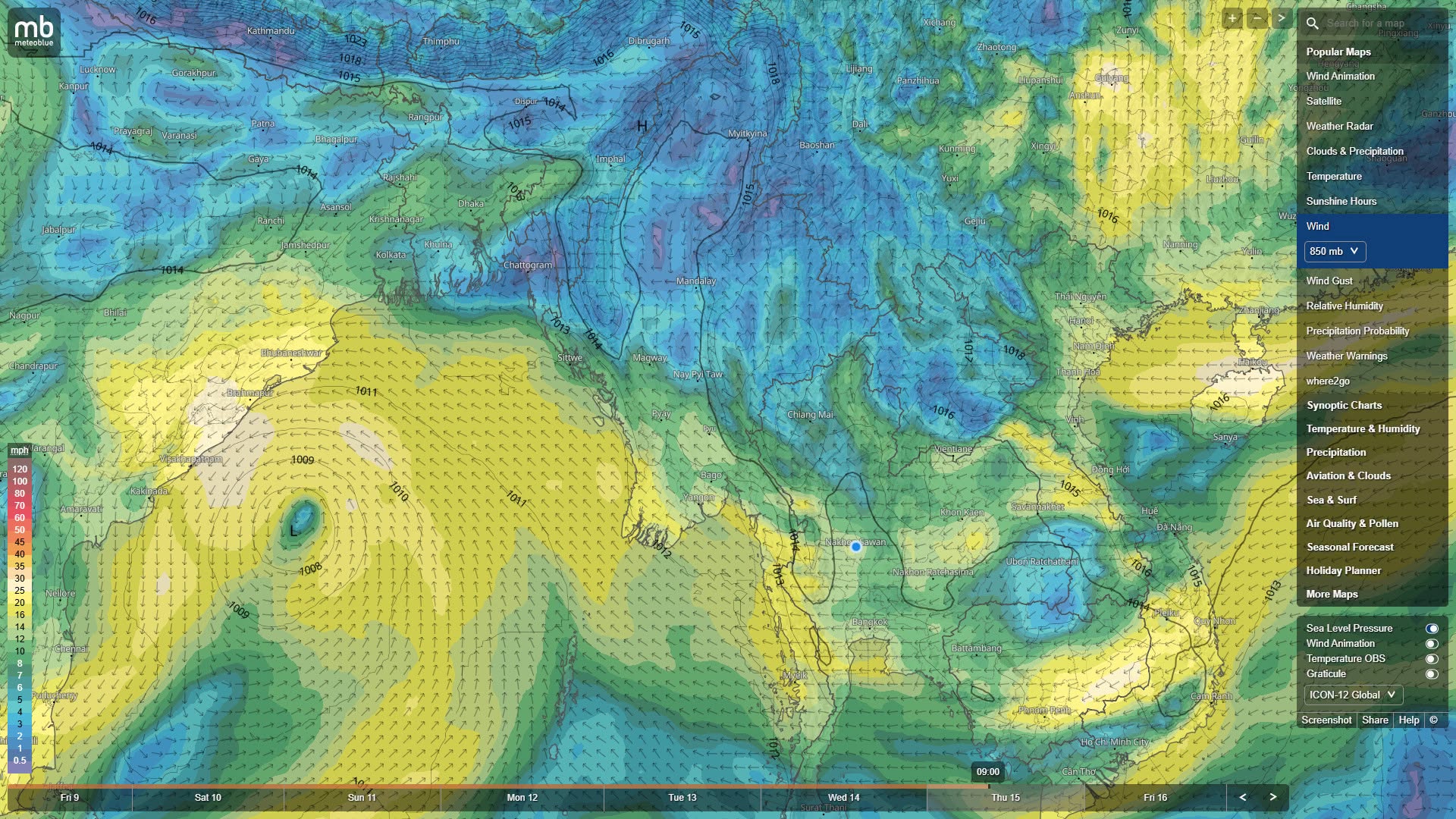
Weather expert says rains will intensify again next week due to Bay of Bengal low-pressure area
October 9
According to a statement from the India Meteorological Department (IMD), an upper-level cyclonic circulation has begun to form over the Gulf of Thailand and its surroundings, and around October 11 it will move into the Andaman Sea and merge, and due to that system, a low-pressure area may begin to form in the southeastern Bay of Bengal around October 13, according to an assessment by weather expert U Win Naing.
According to the ICON Model's statement, the low-pressure area will move from the southeast toward the west-northwest, and between October 14 and 16 it will strengthen further in the west-central Bay of Bengal, it said.
According to the India Meteorological Department (IMD)'s forecast for the coming week, there is a slight chance it could transition into a minor storm on October 15 to 16, it said.
The low-pressure area that will form in the Bay of Bengal will not enter Myanmar directly and will head toward the Indian offshore area, but due to that system, between October 13 and 16, moist air waves will move into Myanmar's coastal areas and southern/central regions, and rains will intensify again, it said.
Between October 9 and 10, most of upper and central Myanmar will see little rain, and only southern Myanmar (Tanintharyi Region) and some eastern border areas may see scattered rain, it said.
Between October 11 and 12, due to the meeting of cold air from mainland China and a low-pressure system, cumulonimbus clouds will bring rain to Shan State (southern and eastern), Kayah State, Kayin State, Mon State, Tanintharyi Region, Bago Region, Yangon Region and Ayeyarwady Region, it said.
Between October 13 and 15, along with the low-pressure area beginning to form in the Bay of Bengal, rainfall will rise again across Tanintharyi Region, Mon State, Kayin State, Bago Region, Yangon Region, Ayeyarwady Region, Rakhine State and Sagaing Region (upper/northern) areas, it said.
On October 16, because the low-pressure area moves westward, rain will ease again in central regions, but rain may continue in coastal and southern areas, it said.
The areas that may receive the most rain are Tanintharyi Region, Kayin State, Mon State, Ayeyarwady Region, Bago Region (eastern/southern) and Yangon Region, where, due to instability of the monsoon trough and low-pressure systems in the Andaman Sea/Bay of Bengal, heavy rain may fall between October 10 and 15, it said.
The areas that may receive moderate rain are Shan State (southern/eastern), Kayah State, Bago Region (western), Rakhine State and Sagaing Region (upper), where cumulonimbus clouds may move in, so lightning strikes, lightning flashes, strong winds and hail may occur alongside, it said.
In particular, in Sagaing Region (upper) and Shan State, rains may intensify again after October 13, and care should be taken regarding flash floods, weather expert U Win Naing warned.
The areas that may receive little rain are Sagaing Region (lower), Mandalay Region, Magway Region and Chin State, where rainfall amounts will be low and only scattered light rain may fall, it was advised.
MyoTaw News Channel
Local News
In Shwe Kone ward, Kyauktan town, Thanlyin district, Yangon region, a minor girl was…
 Local News
About 32.6 percent of Myanmar's population — roughly 17.9 million people — are suffering…
 Local News
Singer Set Naing, who had been evading authorities after receiving a military conscription summons,…
 Local News
Three paramotor aircraft that took off from Kapa Sa 12 in Magway Region's Thayet…
